
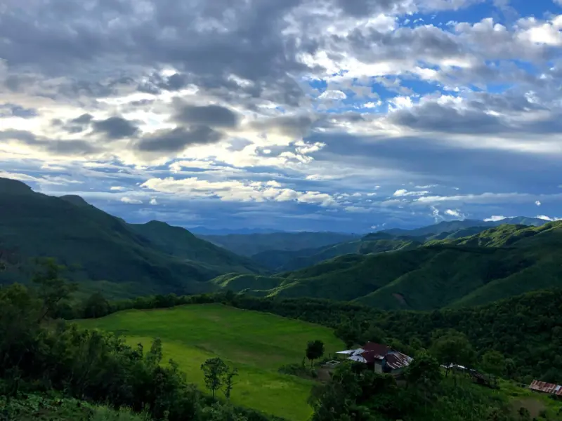

Mizoram, a northeastern gem known for its lush green hills and sweeping vistas, offers sights that resemble scenes from a painting. Its landscape, though relatively devoid of ancient architectural marvels, captivates visitors with verdant rolling hills that dominate nearly every corner of the state.
But behind these picturesque views lies a sobering reality - Mizoram is experiencing one of the fastest rates of forest cover loss in Northeast India.
According to data from Global Forest Watch, Mizoram had 2.00 million hectares of natural forest in 2020, covering an impressive 94% of its land area. However, by 2023, the state had lost 21.8 thousand hectares of natural forest, releasing approximately 11.2 million tonnes of CO₂ into the atmosphere. From 2002 to 2023, the state lost 17.5 thousand hectares of humid primary forest, which accounted for 5.7% of its total tree cover loss. This translated into a 5.9% decrease in the total area of such forests over the same period.
A broader analysis of the northeastern region revealed a startling pattern. Mizoram was among the top five states accounting for 60% of all tree cover reduction in India between 2001 and 2023. Assam led the loss with 324,000 hectares of tree cover gone, followed closely by Mizoram at 312,000 ha, Arunachal Pradesh at 262,000 ha, Nagaland at 259,000 ha, and Manipur at 240,000 ha.
The cost of development and tradition
The causes behind this sharp decline in forest cover are multifaceted. Margeret Lalramchhani, Indian Forest Service (IFS) officer from Mizoram, told EastMojo that a large portion of deforestation is driven by infrastructure projects such as national highways, railway lines, and power transmission corridors. These projects, while contributing to connectivity and development, are often laid out at the cost of dense forest lands, converting them into non-forest areas.
Additionally, she pointed to illegal logging and transportation of timber outside the state through Bairabi Railway Station, often conducted by private forest owners and operators in the wood-based industries. She said, "Most of the time when trees are felled, the landowners replant fast-growing commercial trees like areca nut," which do not support the same level of biodiversity.
She added that a key driver of the forest loss is the age-old agricultural practice of shifting cultivation or jhum farming, which is still widely practised in Mizoram.
A study conducted by researchers from the Department of Forestry and the Department of Environmental Science at Mizoram University found that, under current practices where a cropping period of 2 years is followed by a fallow period of 5 years, shifting cultivation in Mizoram clears approximately 57,577 hectares of land annually.
Among the greenhouse gases (GHGs) emitted, carbon dioxide (CO₂) contributes the most, with estimated emissions of 2,620.27 megagrams (Mg) per year. While emissions of other GHGs are lower in volume than CO₂, their higher global warming potential makes them significant contributors to atmospheric warming.
The study notes that land use planning in areas affected by shifting cultivation is particularly challenging, as the practice is deeply rooted in the cultural traditions of local farming communities.
The researchers recommend identifying and promoting practical and culturally acceptable alternatives to shifting cultivation. Implementing appropriate land-use systems is crucial to balancing ecological sustainability with the socio-economic realities of the region.
Environmental activist David Khiangte echoed this view, saying shifting cultivation is the primary reason for the alarming forest loss. He criticized the state's afforestation and reforestation efforts, calling them "cosmetic and ineffective." Khiangte warned of long-term consequences, including soil erosion, climate change, biodiversity loss, and worsening water scarcity.
Water crisis reflects broader ecological imbalance
Environmental degradation is already manifesting in real-time consequences. Earlier this month, Lunglei, Mizoram's second-largest town, experienced a severe water shortage due to the drying up of the Tlawng River, its main water source. According to a report in the Hindustan Times, the town had not received significant rainfall since January, severely depleting natural water sources.
In response, the government had to transport water by tankers from the Mat River, in collaboration with the Lunglei Truck Owners' Association, to meet daily demands.
Officials from the Public Health Engineering (PHE) Department said the department could pump only 1.5 million litres per day, while Lunglei requires 3.5 million litres daily.
Mizoram's total forest and tree cover was once celebrated, with 19,277 sq. km (91.44%) of the state's geographical area under forest cover, according to the Forest Survey of India, 2013.
Yet, the same report noted that 13,016 sq. km were classified as open forests, vulnerable to degradation from shifting cultivation, unregulated logging, and fire.
Also Read; Let locals lead: How Dzükou Valley can balance tourism and conservation