
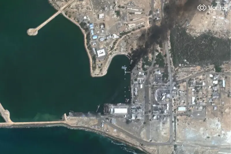

Tehran: Satellite imagery has emerged that shows the devastation caused by the United States military airstrikes on Iran's strategic port region of Konarak.
The imagery shared by Damien Symon, a geo-intelligence and OSINT expert -- on his social media account on X-- shows smoke billowing from the port, and the extent of damage caused by the airstrikes.
The imagery shows at least three Iranian surface ships destroyed and sunk. It also shows at least six buildings on site as damaged, besides a floating dock and patrol boats.
Earlier, satellite imagery had revealed the extent of damage to the nearby Konarak airbase. The base sustained heavy impacts, with imagery revealing dark burn marks and structural breaches on several hardened aircraft shelters.
While the base's runways remain largely visible, adjoining operational zones show clear signs of disruption. Similar devastation was noted at a drone-related installation close to the airstrip, where structures have collapsed, and debris is scattered across the compound.
Analysts have also identified damage to fortified storage positions and bunker-like enclosures, many of which show direct impact points and disturbed ground patterns indicative of precision strikes.
These tactical losses occur amidst a major regional escalation that began with large-scale attacks on Saturday. The operation, which targeted ballistic missile sites and naval assets across Iranian territory, has led to explosions in multiple cities, including Tehran.
Iranian officials report that the death toll has exceeded 200 people since the offensive began. The conflict has since broadened, with Hezbollah launching strikes on Israel and Iran retaliating with missile attacks across the Gulf region, targeting locations in Israel and surrounding territories.
While international actors, particularly in Europe, are pushing for de-escalation, the intensifying exchanges have heightened global concerns of a full-scale confrontation in West Asia.