
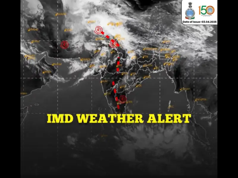

A massive band of clouds stretching nearly 1,000 kilometres across parts of India and Pakistan has been captured in recent satellite images, signalling an approaching spell of rain and thunderstorms across several northern states.
The images, released by the India Meteorological Department (IMD), show a dense cloud formation covering large swathes of northwest India and adjoining Pakistan, indicating the movement of a significant weather system across the region.
Meteorologists say the cloud mass is associated with an active western disturbance, a weather phenomenon that typically brings rainfall, thunderstorms and gusty winds to northern India during the winter-spring transition period.
Western Disturbance Driving Unstable Weather
According to weather experts, the system has formed due to a western disturbance moving across East Iran and Afghanistan, along with an upper-air cyclonic circulation over eastern Rajasthan. This combination has created atmospheric instability, resulting in the formation of a long and dense cloud band visible in satellite imagery.
The cloud system is moving eastward and is expected to influence weather conditions across large parts of north and central India over the next few days.
Check States Likely to Receive Rain and Thunderstorms
Forecasts indicate that rain, thunderstorms and gusty winds are likely across several north-western states, including:
-Jammu and Kashmir
- Himachal Pradesh
- Punjab
- Haryana
- Rajasthan
As the system progresses, rainfall activity may extend to Uttarakhand, Uttar Pradesh, Madhya Pradesh and Chhattisgarh in the coming days.
The India Meteorological Department has warned that thunderstorms accompanied by lightning and winds of up to 40-50 km/h could occur in parts of northern India within the next 24 hours.
Possible Impact: Temperature Dip and Hail in Some Areas
Meteorologists say such large-scale cloud formations often indicate high moisture inflow and atmospheric instability, which are key conditions for rainfall and severe weather events. In isolated areas, moderate to heavy rainfall, short intense showers, lightning and even hailstorms may occur.
While the showers may offer temporary relief from rising temperatures, experts caution that heavy rainfall could disrupt daily activities, affect standing crops and cause waterlogging in some urban areas.
Relief From Heat, But Only Temporarily
The rainfall is expected to bring a brief drop in temperatures across northern India. However, meteorologists say the cooling effect may not last long. Once the system moves away, temperatures could begin rising again, bringing back warmer conditions typical of the early summer season.
Weather agencies continue to monitor the evolving system and have advised residents and farmers to stay updated with official advisories as the weather disturbance moves across the region.
Disclaimer:Weather forecasts are for guidance only. Conditions may change rapidly. Always check local authorities for emergencies and travel alerts.