

Vijayawada: The Andhra Pradesh government's Disaster Management department released a new official map of the state in line with recent administrative changes aimed at improving governance.
The map, published on April 2, reflects the reorganisation of districts and provides updated geographical clarity.
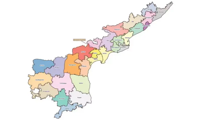
A key highlight of the map is the clear identification of Amaravati as the state capital. It has been prominently marked at the junction of Guntur, Krishna, NTR, and Palnadu districts. Notably, while Amaravati has been designated as the capital, no separate boundary has been demarcated for it in the map.
The updated map also incorporates the newly created districts of Markapuram and Polavaram, taking the total number of districts in the state to 28, up from the earlier 26. The boundaries of all districts have been distinctly outlined.
Officials said the primary objective of releasing the revised map is to ensure better administrative coordination, especially during natural disasters and emergency situations. The map is expected to eliminate confusion regarding district boundaries following the recent reorganisation and aid in more effective district-wise disaster response.